We are starting out slowly. We left Detroit Lakes about 1 PM on June 24. That is the latest start we have ever had but we wanted to spend a little more time with Hans and Nettie. We knew 2 days would be quite a push to get to Banff but 2 1/2 days would make the trip easier.
We boondocked one night at a WalMart in Minot, North Dakota and the second night at a WalMart in Havre, Montana. Along the way, we took some pictures of fields that we passed.


It was too early to stop at a WalMart, so we found a brew pub and stopped in for an hour.

We spent a night in a WalMart in Calgary. I am so glad we decided to leave Minnesota 1/2 day early. We had so much road construction in North Dakota and Montana that we were slowed down a lot.
After we hit Calgary, we stopped in a brew pub for a quick refreshment. Unlike the US, these close at 7 PM.

Banff, Alberta
On Thursday, June 29, we finally reached Banff. We are staying in Tunnel Mountain 2, outside of Banff. The provincial parks (at least this one) are not spacious like the national parks in the US. Even with the clouds, the view is beautiful.


We went to the Visitor Center, on of our first stops at most locations.


We bought some bear spray at the visitor center. It is said this works 90% of the time. Is that supposed to make me feel more secure???
After the visitor center, we walked around the quaint streets of Banff for a while, before looking for a brew hub. We found the Banff Ave Brewing Co, where we watched the Twins game on Gameday and chatted with three people from California. They were very familiar with the Twins and their record this year. That made me happy because I don’t think our team gets enough recognition or respect.
Our server was from Australia. She came here a year ago to hike the mountain trails and never left!

One of the things we are experiencing is the use of metric systems. The truck can convert miles per hour to kilometer per hour but a temperature gauge in Centimeters looks cold! We have had temps of 7 t0 17. At 7, it is about 45 Farenheit!
We walked around the campground in the evening and found some animal poop. Later research showed it to be bear poo, very close to the campground. I’m very glad we did not see the bear.
The next day, we drove up to Lake Louise. We were unable to get into any of the parking lots to get to the lake. This is Canada Day weekend in Canada, like our Independence Day. There are so many tourists. We decided we would still have a lot of scenery in the coming weeks so decided not to be discouraged.


Hinton, Alberta
We drove along the Icefields Parkway, through Jasper National Park, to Hinton, to Cougar Creek Campground. Unlike our stay in Banff, this was a private campground. The weather report along the way was for rain, sometimes torrential. We were lucky and only ran into a few sprinkles. A short ways away from our destination, it rained pretty hard but stopped just before we had to set up camp. It started again, after we had finished. Weren’t we lucky!
We ran into a minor difficulty shortly into this drive. We missed the exit to the Parkway! Luckily, there was a spot to u-turn, about 10 miles away. In most cases, that would not be possible for 50 miles or more.
This drive is gorgeous, even on an overcast day.


We took a 10 minute hike to Mistaya Canyon. It was really neat to see how deep the river has cut through the rock.


We found some female big horn sheep and their babies, beside a waterfall. At first I thought these were mountain goats because of the smaller horns, but they are female big horn sheep. They were pretty rough looking, as their coats were moulting.


The only other animal we saw that day was a white footed rabbit. We were not able to get a picture but googled and found out it is a type of jackrabbit.

In Jasper National Park, we turned off, onto the Yellowhead Highway to complete our drive to Hinton.


Grand Prairie, Alberta
We drove the Bighorn Drive on this leg of our journey and saw beautiful scenery, leaving a mountainous. There was not a lot of traffic and the road was good.


One of the things we saw was strip coal mining. The rocks are BLACK!

We drove through a wildlife sanctuary for caribou but only saw yellow caribou.

We saw a bear, I think a black bear, but we weren’t close enough to see its features to know for sure if it was a black bear or a grizzly. It was in the long grass by the road but we had a narrow shoulder and traffic behind us so could not pull over so did not get a picture. It was neat to see and I know we will see more for photo ops.

We saw a lot of both lumbering and petroleum industries. I found out later that the government dictates how much timber can be harvested and that reforestation is mandatory. On average, they replant two trees for every one harvested.
We stopped in Grand Cache at the Visitor Center and a picnic lunch. We had a welcoming committee of one!


I learned some things about a beaver. They build dams to stop the noise; they really like peace and quiet instead of the gurgling of the water. They have a third, opaque eyelid that drops down when they are under water so they don’t get silt into their eyes. They also have a flap that drops down behind their teeth that keeps water and silt out when chewing on logs under water.
We are headed for a different kind of mountain. Less rocky, looks more like the Appalachians.


Grand Prairie, Alberta
When we got to Grand Prairie, we checked into our camp ground, at a golf course. Their computer system was down so they did not know if they had a space in their main park. So, they gave us a site in the overflow site. We were the only campers!

Then we went grocery shopping to stock up. We had been told that prices were higher in British Columbia. We were stumped by a few things different from “home”. American cheese packaging was different, even though it is Kraft brand in both cases. We usually eat David sunflower seeds and someone had told us they bought a brand they did not like. We found an unfamiliar brand and almost got them, then found some Planter’s and decided to get them. Time will tell! Another thing is that we have a tradition of having Bloody Mary’s on Sunday mornings. People look at us funny when we ask for bloody Mary mix! We have enough for one more Sunday. After that, we may have to experiment with making our own.
The next morning, I woke up to the sound of a very loud raven. The Indigenous People respect this bird but call it “tricky”.
We drove over to the Visitor Center where there were some really helpful people who gave us some useful printed material. We toured the museum there and reviewed more history of the area, industry (petroleum and timber), area wildlife and dinosaurs. This area had many dinosaurs and it was enlightening to see bones and fossils with footprints.
In the parking lot, there is a huge sundial. We were there on a cloudy day so were not able to see how it worked but I liked it a lot.

Dawson Creek, British Columbia
We drove the Eat Access Route to Dawson creek, a short 81 mile drive.


Just east of Dawson Creek, we saw a caribou near the road. Again, I was not able to get a picture. I sure hope I do better in the future!
We finally made it to Dawson Creek and did some exploring. First stop was the Visitor Center and famous Highway sign.


Then we went to the Visitor Center and museum. Dave watched a very long film about the making of the Alaska Highway. I only lasted about 1/2 hour, half way through. It was interesting though. This highway had been proposed many times but was finally approved after the Japanese bombed Pearl Harbor. It was felt the US and Canada needed to protect Alaska from the Japanese who had landed on the Aleutians Islands. The first road was a dirt road, build it only 8 months, covering 1,387 miles. It runs from Dawson Creek to Delta Junction.


It was noon, with time change so an hour later for us and we were hungry. We found a little coffee shop, the Eats and Treats Cafe, that also serves sandwiches and soup where we shared a yummy chicken cordon bleu panini and creamy broccoli soup.

We took a walking tour around the old downtown area. Many buildings are no longer there but there are murals on building walls, depicting the original buildings.


We checked into our campground, Tubbie’s RV Park and Car Wash!!! This is probably not my favorite campground, but it is only for one night!

We are getting closer to the Land of the Midnight sun. It had been daylight until 10:30 PM. Dave was up at 4:00 AM today and it was already light!
Fort Nelson, British Columbia
We drove the Alaska Highway to Fort Nelson.

We drove part of the original Alaska Highway, including this bridge which took 9 months to build, about the same as the original highway. It is the only original wooden bridge remaining in use on the highway.


Jo goes a little crazy taking pictures of flowers.


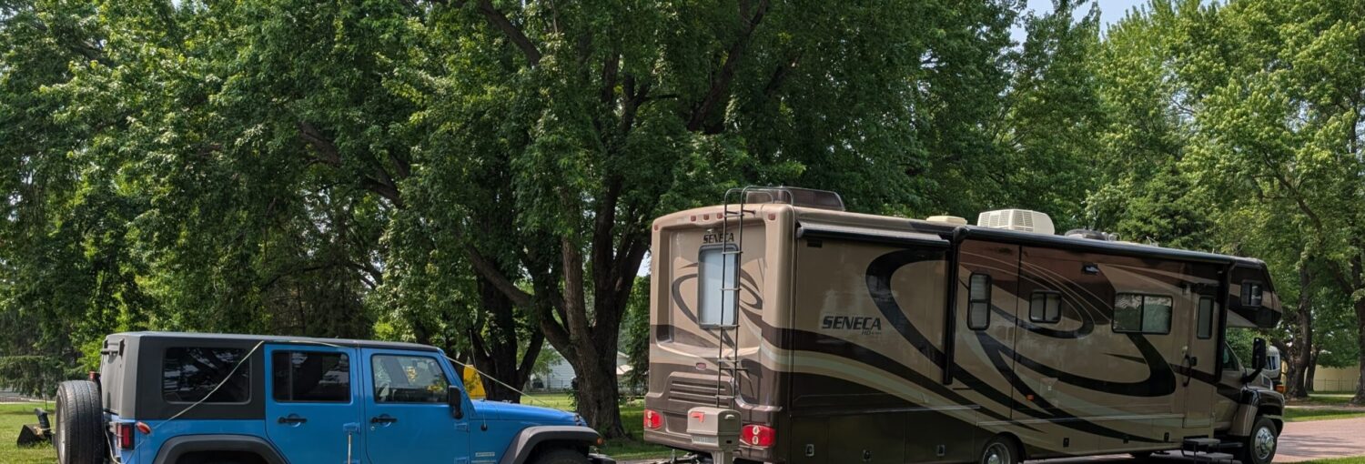
Made it to our campground in Fort Nelson.

We went through a museum near the RV park. This museum had a little of anything and everything. The best part was the building with very old cars, mostly Canadian and British. The Canadian cars were American made but had Canadian name plates example, there was a 1950 Mercury pickup, which was the same as a Ford pickup. The volunteer on duty was very knowledgeable and proud of “his” cars.
We met two couples while at this park. One was from about 350 north of Edmonton and the other was from Vancouver. It was interesting to talk to them and learn of things to do and see along the way.
